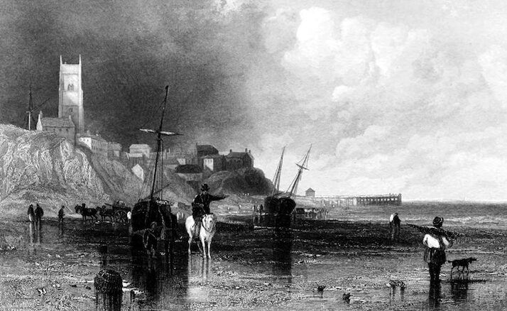
Daniel Defoe describes this stretch of coast, from the Thames to Yarmouth Roads, as one of the ‘most dangerous and fatal to English sailors’ in all Britain. He describes the challenges to vessels if a storm blows up as they sail northwards or south, and reflects on the number of farm buildings which are constructed of salvage from the many wrecks along this coast.
This coast, [which] is particularly famous for being one of the most dangerous and most fatal to the sailors in all England, I may say in all Britain; and the more so, because of the great number of ships which are continually going and coming this way, in their passage between London and all the northern coasts of Great-Britain. Matters of antiquity are not my enquiry, but principally observations on the present state of things, and if possible, to give such accounts of things worthy of recording, as have never been observed before; and this leads me the more directly to mention the commerce and the navigation when I come to towns upon the coast, as what few writers have yet medled with. The reason of the dangers of this particular coast, are found in the situation of the country, and in the course of ships sailing this way, which I shall describe as well as I can, thus; the shoar from the mouth of the river of Thames to Yarmouth Road, lies in a strait line from S.S.E. to N.N.W. the land being on the W. or larboard side.
From Winterton Ness, which is the utmost northerly point of land in the county of Norfolk, and about four miles beyond Yarmouth, the shoar falls off for near sixty miles to the west, as far as Lynn and Boston, till the shoar of Lincolnshire tends north again for about sixty miles more, as far as the Humber, whence the coast of Yorkshire, or Holderness, which is the East Riding, shoots out again into the sea, to the Spurn, and to Flambro’ Head, as far east almost as the shoar of Norfolk had given back at Winterton, making a very deep gulph or bay, between those two points of Winterton and the Spurn Head; so that the ships going north, are oblig’d to stretch away to sea from Winterton Ness, and leaving the sight of land in that deep bay which I have mention’d, that reaches to Lynn, and the shoar of Lincolnshire, they go, I say, N. or still N.N.W. to meet the shoar of Holdemess, which I said runs out into the sea again at the Spurn; This they leave also and the first land they make, or desire to make, is called as above, Flambro’ Head; so that Winterton Ness and Flambro’ Head, are the two extremes of this course, there is, as I said, the Spurn Head indeed between; but as it lies too far in towards the Humber, they keep out to the north to avoid coming near it.
In like manner the ships which come from the north, leave the shoar at Flambro’ Head, and stretch away S.S.E. for Yarmouth Roads; and the first land they make is Winterton Ness (as above). Now, the danger of the place is this; If the ships coming from the north are taken with a hard gale of wind from the S.E. or from any point between N.E. and S.E. so that they cannot, as the seamen call it, weather Winterton Ness, they are thereby kept in within that deep bay; and if the wind blows hard, are often in danger of running on shoar upon the rocks about Cromer, on the north coast of Norfolk, or stranding upon the flat shoar between Cromer and Wells; all the relief they have, is good ground tackle to ride it out, which is very hard to do there, the sea coming very high upon them; Or if they cannot ride it out then, to run into the bottom of the great bay I mention’d, to Lynn or Boston, which is a very difficult and desperate push: So that sometimes in this distress whole fleets have been lost here all together.
The like is the danger to ships going northward, if after passing by Winterton they are taken short with a north-east wind, and cannot put back into the Roads, which very often happens, then they are driven upon the same coast, and embay’d just as the latter. The danger on the north part of this bay is not the same, because if ships going or coming should be taken short on this side Flambro’, there is the River Humber open to them, and several good roads to have recourse to, as Burlington Bay, Grimsby Road, and the Spurn Head, and others, where they ride under shelter. The dangers of this place being thus consider’d, ’tis no wonder, that upon the shoar beyond Yarmouth, there are no less than four light-houses kept flaming every night, besides the lights at Castor, north of the town, and at Goulston S, all which are to direct the sailors to keep a good offing, in case of bad weather, and to prevent their running into Cromer Bay, which the seamen call the Devils Throat.
As I went by land from Yarmouth northward, along the shoar towards Cromer aforesaid, and was not then fully master of the reason of these things, I was surprised to see, in all the way from Winterton, that the farmers, and country people had scarce a barn, or a shed, or a stable; nay, not the pales of their yards, and gardens, not a hogstye, not a necessary-house, but what was built of old planks, beams, wales and timbers, &c. the. wrecks of ships, and ruins of mariners and merchants’ fortunes; and in some places were whole yards fill’d, and piled up very high with the same stuff laid up, as I suppos’d to sell for the like building purposes, as there should be occasion.
Daniel Defoe, A tour thro’ the whole island of Great Britain, divided into circuits or journies Letter 1 part 3: Norfolk and Cambridgeshire, 1727 (London: JM Dent and Co, 1927)